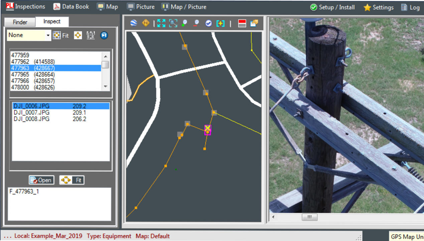
Merging GIS and BIM data introduces a geospatial element into structure design and asset management, which leads to safer and smarter buildings and infrastructure.
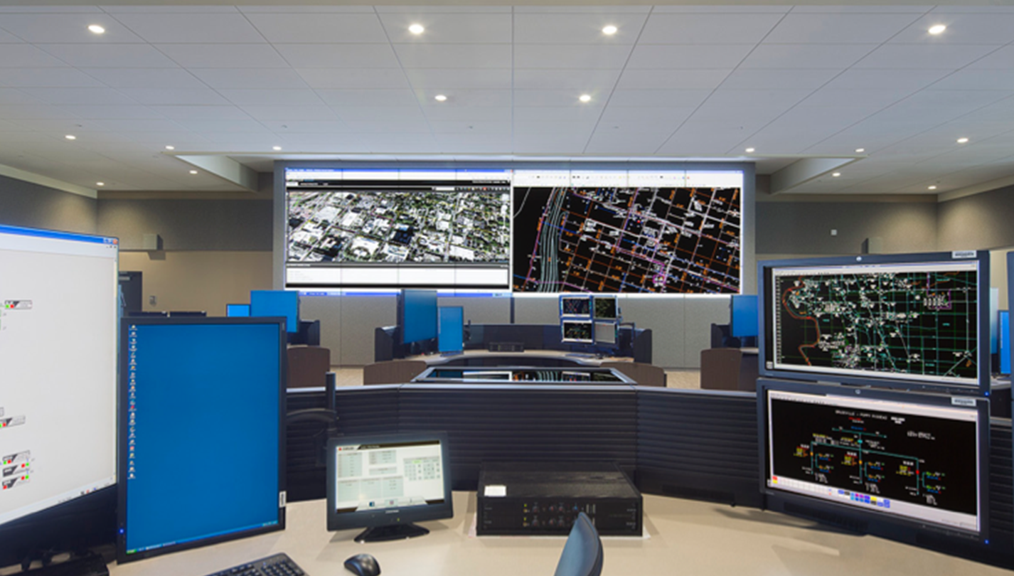
Turn Real-Time Data Into Business Insights
Turn Real-Time Data Into Business Insights
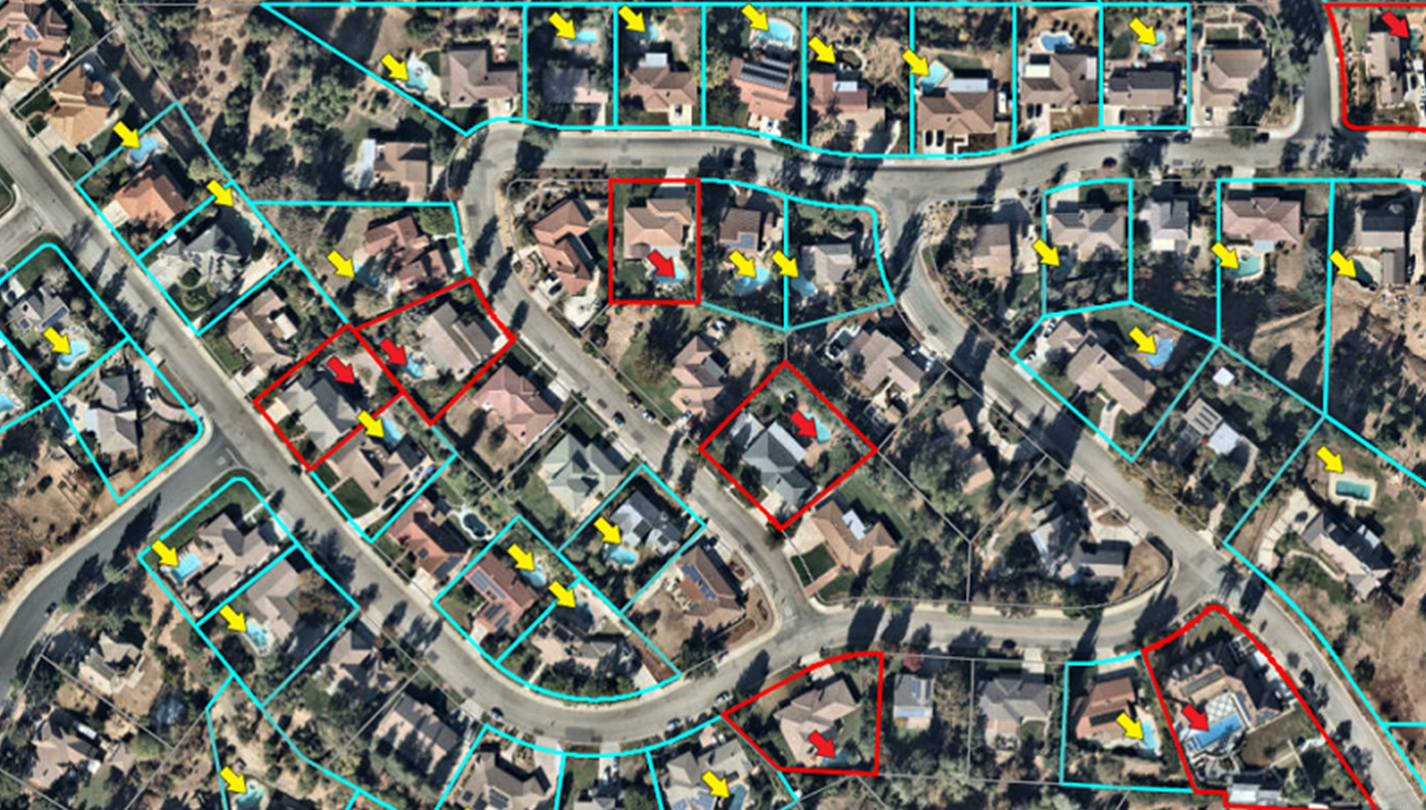
Integrate GIS mapping and scan data with other data sets to gain insights, plan for growth and respond quickly to issues. GIS data is essential to determining demographics and demand allowing for proper placement of new builds.
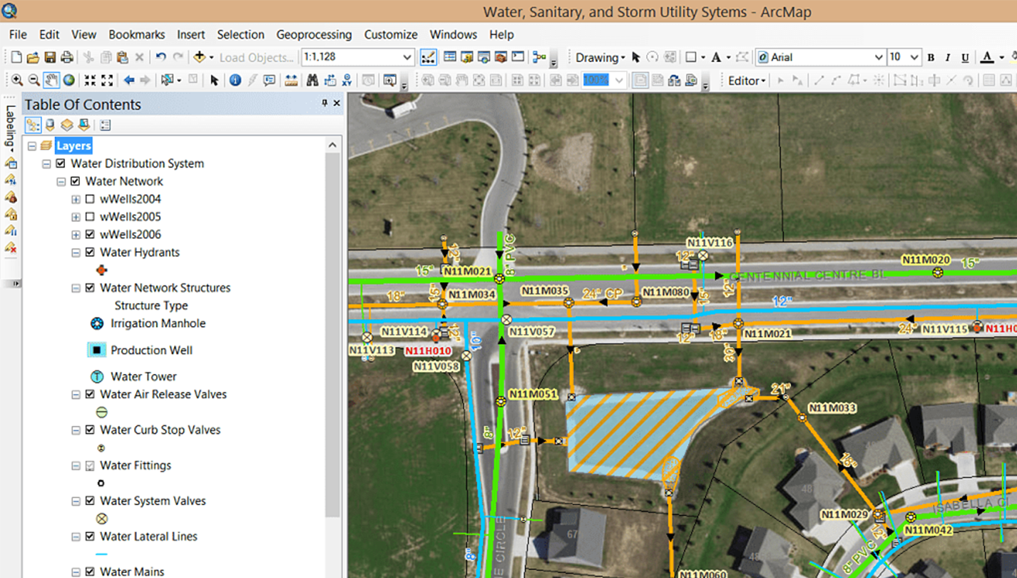
Geo-Plan
Integrate geographical data for more informed decision making.
Real-Time Data
Make quick, intelligent business decisions.
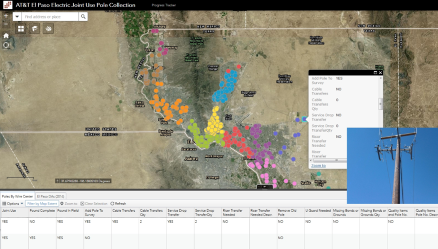
Collaboration
Share maps and tools to put insights into action.
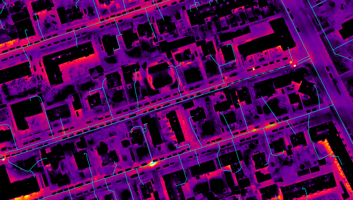
Combining GIS with drone data yields powerful insights and intelligent decisions.